Frederick Hester : A brief history in pictures - Page 17b : From Horse to Electric
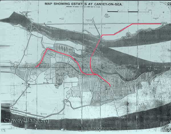
1902 Hester Map clearly showing the planned route for electrification
The 1902 map above that recently came to light is an early development plan for Canvey showing roads and estates named by Frederick Hester (i.e. Kloster Park etc). More interestingly for this section is the planned electrification and expansion of the Mono Rail. Far left we see the (north south) narrow gauge route through the Winter Gardens and from left to right we see the other existing route from the Winter Gardens, parallel to Central Wall road & north of the High Street, round Smallgains corner alongside Westerland Ave and crossing the High Street to the Sea Front along side Seaview Road (not shown here). The plan was to meet up with his Pier (See later). A third route was also planned (centre - north south) from Smallgains to Leigh Station by extending the Salvation Army Jetty at Hadleigh (see below).
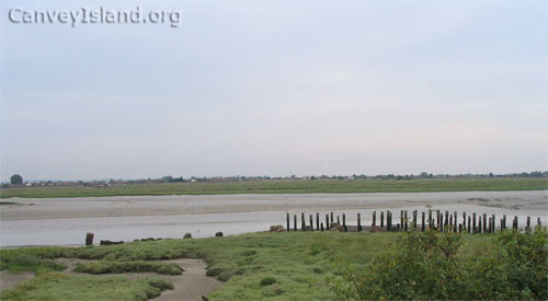
Looking South over to Canvey with the derelict Salvation Army Jetty